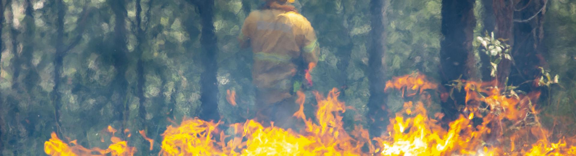
Emergency Contact
Low, orange flames in the foreground generate a heat wave slightly obscuring a fire officer in the background

Planned burns

As a major landholder and statutory authority, Seqwater has a responsibility to address fire management in our catchments.

We conduct planned burns before the bushfire season to help protect our local communities, properties, and the environment. These controlled burns reduce bushfire risks by managing dense vegetation and natural fuel hazards.

Hide    Show   
Home What We're Doing Planned burns

Your safety is important to us. Each year, our controlled burns reduce bushfire risks by managing dense vegetation and natural fuel hazards. Areas with the most fire risk are prioritised using data and criteria that includes time since the last burn, amount of vegetation growth and surrounding neighbourhoods.

Each of our planned burns adhere to strict guidelines set by the Queensland Fire and Emergency Services (QFES). These guidelines consider essential factors like temperature, humidity, wind speed, and direction which help to inform decisions about planned burns and ensures burns are conducted safely.

When burns will be held

Most of Seqwater’s planned burns take place between March and September. There may be some burn activity outside of this period, weather permitting. Some planned burns may be cancelled up to and including the schedule day if the weather is unsuitable.

While we can’t advise specific dates for burns, residents will receive a postal letter ahead of time. Notifications are also posted on our Facebook and Twitter pages on the day of a burn.

Find out more by downloading Seqwater's Fire Management Fact Sheet.

Schedule for 2024

Our planned burn schedule by region is listed below. Not all planned burns on this schedule may be progressed this season, depending on conditions. 

Northern region

  • Aspley Reservoir
  • Borumba Dam
  • Cooloolabin Dam
  • Enogerra Dam
  • Ewen Maddock Dam
  • Sideling Creek Dam (Lake Kurwongbah)
  • Lake Macdonald Dam
  • North Pine Dam (Lake Samsonvale)
  • Sparkes Hill Reservoir

Central region

  • Gold Creek Reservoir
  • Jimna WTP
  • Clarendon Dam
  • Manchester Dam
  • Somerset Dam
  • Wivenhoe Dam
  • Mt Crosby (Mt Crosby/Kholo area)

Southern region

  • Bromelton
  • Hinze Dam
  • Leslie Harrison Dam
  • Little Nerang Dam
  • Heinemann Rd Reservoir
  • Maroon Dam
  • Molendinar WTP
  • Moogerah Dam
  • Minjerribah (North Stradbroke Island)
  • Wyaralong Dam

Smoke alerts and updates

Smoke alerts and new information will be updated here regularly.

Thumbnail of planned burn area in Kirkleagh June 2024

Planned burn in Kirkleagh area Tuesday 25 June 2024

Seqwater will commence a planned burn in the Kirkleagh area at 10am on Tuesday 25 June 2024.

The burn is likely to produce a reasonable amount of smoke visible in the Kirkleagh area and from local roads.

Traffic control may in place on local roads. If you are visiting or travelling through the area, please remain vigilant and follow the directions of staff and signage on site.

If you have a respiratory health condition, please follow the advice of your health practitioner and in case of an emergency, call Triple Zero (000).

Thumbnail of Lake Manchester / Mt Nebo planned burn map - June 2024

Planned burn near Lake Manchester/Mt Nebo area Monday 17 June 2024

Seqwater will commence a planned burn near Lake Manchester/Mt Nebo area at 10am on Monday 17 June 2024.

The burn is likely to produce a reasonable amount of smoke visible above Lake Manchester and for the Mt Nebo community.

Traffic control may in place on local roads. If you are visiting or travelling through the area, please remain vigilant and follow the directions of staff and signage on site.

If you have a respiratory health condition, please follow the advice of your health practitioner and in case of an emergency, call Triple Zero (000).

Aerial map of Dunwich with outline of planned burn area

Planned burn near Dunwich WTP Tuesday 11 June 2024

Seqwater has commenced a planned burn near the Dunwich water treatment plant on Minjerribah (North Stradbroke Island) today, on Tuesday 11 June 2024.

The burn is likely to produce a reasonable amount of smoke visible east of Dunwich near the Aero Field.

Traffic control may in place on local roads. If you are visiting or travelling through the area, please remain vigilant and follow the directions of staff and signage on site.

If you have a respiratory health condition, please follow the advice of your health practitioner and in case of an emergency, call Triple Zero (000).

Seqwater Fire Officer conducting a planned burn.

Seqwater’s planned burns season commences soon

Seqwater’s annual program of planned burns for 2024 is set to commence soon, as conditions permit, ahead of bushfire season to help protect local communities, properties, and the environment.  

Seqwater’s annual program of planned burns for 2024 is set to commence soon, as conditions permit, ahead of bushfire season to help protect local communities, properties, and the environment.  

Planned burns are a way to reduce risk and fuel loads, such as grasses and dense undergrowth, and help to mitigate seasonal bushfire risk to the land and catchments Seqwater manages, as well as neighbouring properties.

Seqwater Executive General Manager of Operations, Fiore Zulli, said the first hazard reduction burn of the season will likely be on North Stradbroke Island, pending weather conditions.   

“We’ve had a wet start to the year, but the catchments are drying out and as the temperatures are becoming cooler, we can begin our planned burns program, which typically runs through to September,” Mr Zulli said. 

“Before we commence a planned burn, we carefully consider and analyse the weather conditions which include identifying the ideal temperature, fuel moisture, wind speed and direction, and humidity levels to ensure we can conduct the burn in accordance with our Queensland Fire and Emergency Services (QFES) permit.

“When conducting a planned burn, we also establish conservation protection zones, and consider the best approach to enhance the biodiversity of the area.

“Safety is our priority and we’re always extremely mindful of the impacts that smoke from planned burns may have on the community, and we thank them for their understanding while we undertake this important work.”

Seqwater is committed to proactive fire management and works closely with its neighbours, partners, government agencies, traditional owners, and key authorities to safely facilitate planned burns across the region.

Seqwater encourages the community to keep an eye on their letterboxes for more information about Seqwater’s planned burns. Dam and recreation site visitors should also check Seqwater’s Recreation and Safety notices on the Seqwater website, or download the Seqwater app, for notifications on closures and conditions.

Multiple agencies may be conducting burns at the same time, so it is important to stay up to date with planned burns in your area.

Important information

Smoke impacts

Smoke may still drift and can stay around for up to one week after the planned burns, subject to weather.  During a planned burn, we recommend that you stay indoors, keep your windows and doors closed. Try to avoid outdoor activities in areas affected by smoke including washing and hanging out clothes to dry.

Residents with respiratory conditions

We recommend you stay indoors with windows and doors closed and use an air purifier if available. You should discuss the planned burns with your health practitioner and follow their advice. Ensure you always carry necessary medications with you.

If you start to feel unwell, please contact your health practitioner, and in the case of an emergency, please call triple zero (000).

Other information