What Seqwater is doing to prepare for the cyclone
Updated as at Wednesday 5 March
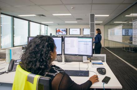
Seqwater's Flood Operations Centre is continuing to closely monitor weather conditions and dam levels; preparing for the probability of prolonged severe weather impacts.
While there are no gated releases currently occurring from Wivenhoe, Somerset and North Pine Dams, this may change in the coming days, pending weather. Operational releases for drinking water supply continue.
Seqwater's Flood Operations Centre moved to 'STAND UP' activation stage this morning. This means we have mobilised teams on site and may begin to make controlled releases of floodwater from our gated dams in the coming days due to forecast rainfall associated with TC Alfred.
We will keep the community updated as our release plans are confirmed, which will be determined after the rain has fallen.
Wet weather preparation
Seqwater is working closely with the Bureau of Meteorology and other stakeholder agencies, as well as its five water retailers - Urban Utilities, Unitywater, Logan City Council, City of Gold Coast and Redland City Council - to prepare for potential wet weather-related impacts.
Seqwater has several early preparation measures underway including optimising the SEQ Water Grid, maximising local water reserves in the event of loss of power at out Water Treatment Plants and stockpiling water treatment chemicals to prepare for potential road closures.
Make sure you stay safe
The community should take the advice of Emergency Services and have a storm kit ready, fill up bottles of water, ensure you have supplies.
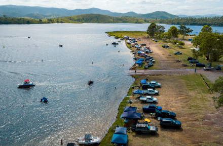
Seqwater would like to remind residents and the community to avoid potential hazards downstream of our region’s dams as gated releases and outflows may start or increase with rainfall. Be cautious of fast flowing or deep water near waterways and remember, if it’s flooded – forget it.
Stay informed and sign up for important updates
For the latest information on dam releases, levels and spilling, residents can visit www.seqwater.com.au/dam-levels or sign up to Seqwater's free dam release notification service.
For more information on weather warnings and river heights, visit www.bom.gov.au, for road closures and transport visit www.qldtraffic.qld.gov.au. You can also stay connected by visiting your local council website.
Frequently asked questions
No FAQs match your query
Seqwater’s legislated manual for flood operations is based on current rainfall on ground in accordance with the approved Flood Manual for Wivenhoe, Somerset and North Pine Dams. We don't release water based on weather predictions, as they can be unpredictable as to where the water actually falls across our catchments.
As at 9am on Wednesday 5 March, Seqwater's Flood Operations Centre moved to 'STAND UP' activation stage. This means we have mobilised teams on site and may begin to make controlled releases of floodwater from our gated dams in the coming days due to forecast rainfall associated with TC Alfred.
We make gated releases in a flood event for several reasons.
Our dams do not hold infinite storage, and as per the Flood Operations Manuals, we make controlled, gated releases in a flood event to firstly manage dam safety to protect the community downstream, followed by water supply, followed by flood mitigation to mitigate impacts downstream.
A flood event is determined by Seqwater’s Flood Operations Centre when predicted lake levels will rise above the approved Operational Full Supply Level at our gated dams, after rain has hit the ground in our catchments.
- For Wivenhoe Dam when it exceeds 90% by 0.15 metres
- For Somerset Dam when it exceeds 80% by 0.5 metres
- For North Pine Dam when it exceeds 54% by 0.1 metres
The amount of water released via the gates at our dams in a flood event will depend on how much rain falls, the intensity of the rain and where it lands in the catchment. We have specialist flood engineers who are monitoring this 24/7.
Seqwater’s manual for flood operations is based on rainfall (on ground) in accordance with the approved Flood Manual for Wivenhoe, Somerset and North Pine Dams.
Seqwater is working closely with the Bureau of Meteorology and other stakeholder agencies, as well as its five water retail providers and we have several early preparation measures underway including:
- Optimising the SEQ Water Grid to help keep water moving around the catchments and
- Maximising local water reserves to help ensure continuity of supply and
- Stockpiling water treatment chemicals to prepare for potential road closures that may impact access to our water treatment plants.
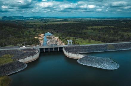
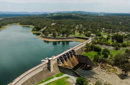
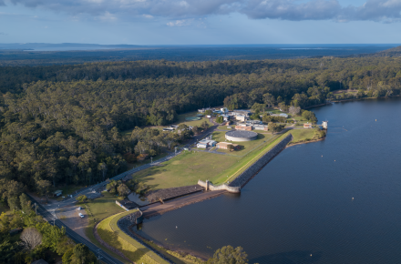
Seqwater manages 25 referable dams across the South East Queensland (SEQ) region – 22 of which are un-gated (such as Baroon Pocket, Borumba, Moogerah and Hinze) and three of which are operated via gates as required (North Pine, Somerset and Wivenhoe).
A map of the Seqwater network can be found here.
At our un-gated dams, excess water naturally flows over the spillway and safely out of the dam into the creek or river system the dam is built on.
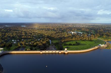
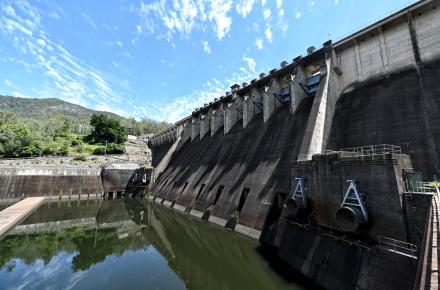
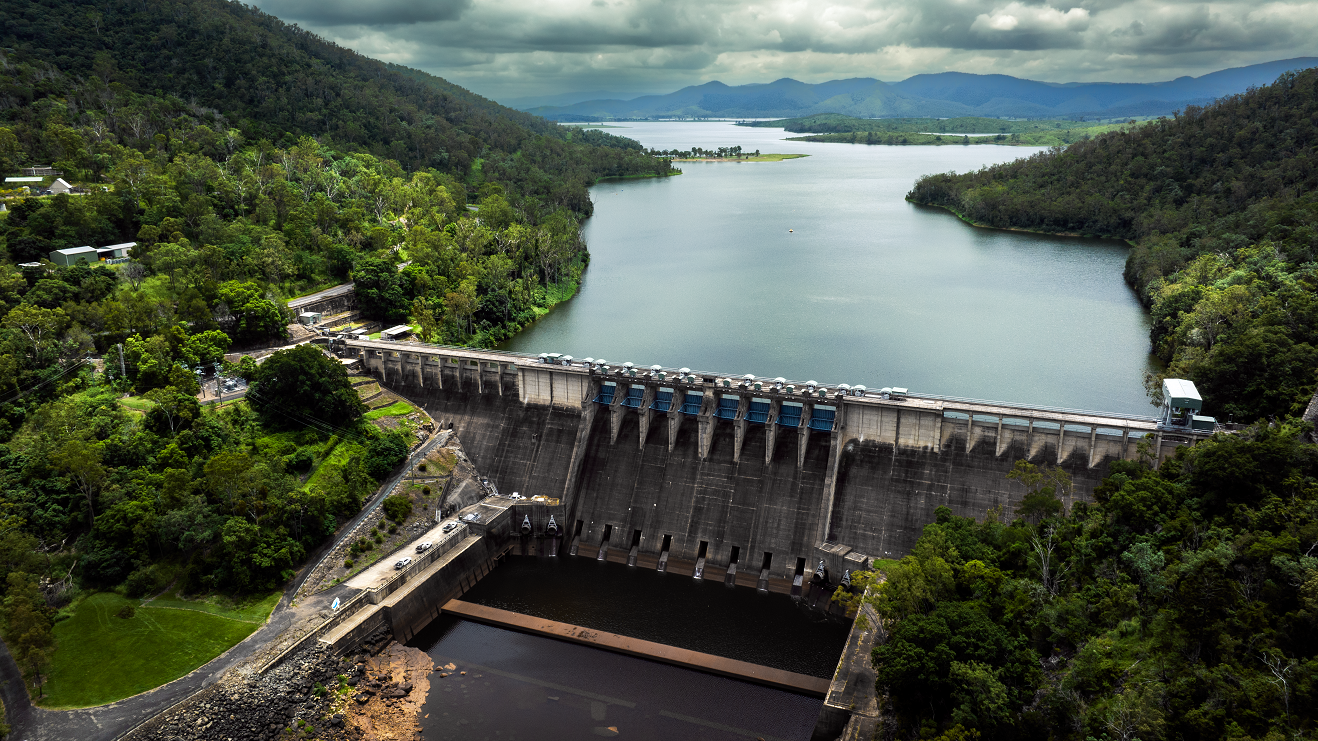
A gated dam is built to enable Seqwater to have some control over the release of water. Seqwater operates three gated dams–Wivenhoe Dam and Somerset Dam in the Somerset Region and North Pine in the Moreton Bay Region.
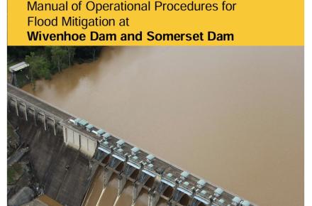
Once a gated dam reaches its Full Supply Level, Seqwater controls the release of water over the spillway using specially designed gates. The operation of the gates is determined by operating rules in the approved Manual of Operational Procedures for Flood Mitigation for Wivenhoe, Somerset and North Pine dams. These manuals are publicly available on the Seqwater website.
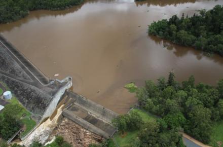
A controlled release of water from a gated dam will not necessarily result in downstream flooding.
Each dam has a full supply level (FSL), which is the approved water storage level of the dam for drinking or irrigation. This FSL is equivalent to 100 per cent supply volume.
The storage level of a dam can rise above 100 per cent when there is water being held in the ‘freeboard’ as well as going over the spillway. The freeboard is a space between the full supply level (how much is held in the dam for drinking water and irrigation) and the level of the dam crest.
The size of a freeboard depends on the dam type, size, spillway and spillway dimension.
Once the full supply level is reached, water can flow out of the dam in multiple ways, depending on the dam design.
Watch more: How can a dam be more than 100%?
South East Queensland’s gated dams – Wivenhoe, Somerset and North Pine – have the ability to store extra water for a period of time before controlled releases of this water commence through gates or valves.
When we say Wivenhoe Dam is 100 per cent full, this means the amount of storage allocated for drinking water and irrigation is full, but additional water (up to 2 million megalitres) can be temporarily stored above this during a flood event.
So when you hear a dam is more than 100 per cent full, it simply means it’s doing what it’s designed to do – releasing excess flood water to keep the dam safe and provide flood mitigation downstream.
The community should take the advice of Emergency Services and have a storm kit ready, fill up bottles of water, ensure you have supplies.
Seqwater would like to remind residents and the community to avoid potential hazards downstream of our region’s dams as gated releases and outflows may start or increase with rainfall. Be cautious of fast flowing or deep water near waterways and remember, if it’s flooded – forget it.
For the latest information on dam releases, levels and spilling, residents can visit www.seqwater.com.au/dam-levels or sign up to Seqwater’s free dam notification service.
For more information on weather warnings and river heights visit www.bom.gov.au, for road closures and transport visit www.qldtraffic.qld.gov.au. You can also stay connected by visiting your local council website.
-
Alert: signifies that forecast rainfall associated with an approaching weather system is indicating that Seqwater may need to release flood water from Wivenhoe Dam, Somerset Dam and/or North Pine Dam.
-
Lean Forward: signifies that based on the rainfall occurring over the dam/s catchment areas, this is likely to lead to Flood Event declaration (release flood water).
-
Stand Up: signifies that the Flood Operations Centre is mobilised to 24/7 operations and a Flood Event is deemed to have started in accordance with the Manuals.
You can check where Seqwater’s 25 dams are located here.
It’s important to know that there can be multiple sources of flooding such as from local creeks, stormwater drains or overland flows. Your local council has a variety of flood information tools to help you understand your individual flood risk.
The Full Supply Level (FSL) of a dam refers to the approved level that water can be stored in the dam for drinking water or irrigation.
When un-gated dams fill, they are designed to pass excess water into the creek or river system they are built on. This is called ‘spilling’ and is not controlled by gates or valves.
For gated dams (Wivenhoe, Somerset and North Pine), if the water level rises above the Full Supply Level, Seqwater will use valves or gates to make controlled releases for flood mitigation and to protect the safety of the dam.
Seqwater will regularly make operational releases from our dams as part of our business as usual operations. This helps provide drinking water to more than 3 million people in the Greater Brisbane area. We often release from our cone valves that sit below our big radial dam gates. Some dams are 'ungated', these are uncontrolled dams, which means when they get full, they overflow naturally.
Flood mitigation is the process of capturing water in a dam and then releasing it downstream at a slower rate. The water is released in a controlled manner through a spillway, with the aim of minimising river levels downstream of the dam.
Dams cannot always stop flooding occurring downstream. This may be because the size of the flood is larger than the dam’s storage capability or the rain has fallen downstream of the dam’s catchment. Dams also do not have an infinite storage capacity and during a flood our teams work to balance the provision of flood mitigation benefits with protecting the integrity and safety of the dam.
When levels go above the Operational Full Supply Level, the Seqwater Flood Operations Centre directs the operation of the dam gates to release water in accordance with the Flood Operations Manual.
The objectives of the Flood Operations Manual are to protect the structural integrity of the dam during flood events, mitigate downstream flooding, reduce environmental impacts and maintain a full drinking water supply at the end of the event.
Somerset Dam is upstream of Wivenhoe Dam. All releases from Somerset Dam end up in Wivenhoe Dam, which is about three times larger than Somerset.
Wivenhoe Dam has a floodwater storage compartment, which enables the dam to temporarily hold back water on top of the drinking water stored in the dam. Wivenhoe Dam can hold 1.165 million megalitres of drinking water, but also has a flood storage compartment of another 1.967 million megalitres. Therefore, the dam has a total storage capacity of 3.132 million megalitres.
Read more: Flood Operations Manual for Wivenhoe Dam and Somerset Dam.
When levels go above the Full Supply Level, the Seqwater Flood Operations Centre directs the operation of the dam gates to release water in accordance with the Flood Operations Manual. The objectives of the Flood Operations Manual are to prevent structural failure of the dam during floods, mitigate downstream flooding, reduce environmental impacts and maintain a full drinking water full supply at the end of the event.
North Pine Dam provides some downstream flood mitigation benefit by capturing rainfall and runoff entering the dam from upstream (inflows) and then releasing excess water (outflows) at a slower rate. This process typically helps to reduce flooding impacts downstream.
Care must be taken not to hold back too much water and risk the structural integrity of the dam.
Read more: Flood Operations Manual for North Pine Dam.
The flood storage compartment is designed to temporarily store floodwater and release it at a controlled rate with the aim of minimising downstream impacts and not exacerbating peak river levels and flows downstream.
Dams do not have an infinite amount of storage space and flood water unfortunately cannot be stored in the dam indefinitely. This excess water must be allowed to pass through the dam during the flood in preparation for any further rain.
Seqwater aims to empty the dam of floodwater after the flood has peaked, so that the flood storage compartment remains available to manage inflows if another rain event occurs. This has to be done relatively quickly, usually within seven days, in case we receive another burst of heavy rain as has happened in previous flood events. This means we generally cannot wait until the flood event has completely passed before releasing water from the dam.
The Manual of Operational Procedures for Flood Mitigation at Wivenhoe Dam and Somerset Dam (or Flood Operations Manual) explains how the flood storage compartments of these dams are used during flood events and is available on the Seqwater website.
There can be many sources of flooding in South East Queensland, and every flood is different. Water released from a gated dam is only one source of water contributing to flows in rivers or watercourses downstream.
Half of the Brisbane River catchment is located below Somerset and Wivenhoe Dams – this includes the Bremer River and Lockyer Creek. As these river systems enter the Brisbane River below Somerset and Wivenhoe Dams, the dams cannot help mitigate flooding from these rivers, and if heavy rain is received downstream of the dams they cannot play a role in mitigating these floodwaters.
Other sources of flooding can include heavy rainfall in downstream areas, flooding from local creeks and tributaries, stormwater drains and overland flows.
Your local council has a variety of flood information tools to help you understand your individual flood risk.
Details of releases from gated dams are provided by Seqwater to the Bureau of Meteorology, which is responsible for calculating river heights and issuing flood warnings. Please follow updates from www.bom.gov.au including severe weather warnings and river levels.
Seqwater works with emergency services, as well as state and local government, to inform and update the community about flood events. During a flood event, Seqwater activates its Flood Operations Centre where dam engineers and staff monitor conditions 24/7.
The best source of information during a flood event is your local council.
You can stay aware of any releases from Seqwater dams by signing up to our free dam notification service or downloading the Seqwater app.
Flood mitigation in the urban areas downstream of North Pine Dam can be affected by other flood water entering the catchment from places such as Sideling Creek (Lake Kurwongbah), the South Pine River, other smaller creeks and surrounding urban areas.
Moreton Bay Regional Council provides information about potential flood risks in the Moreton Bay Region including mapping and tips on how to be prepared. To find out about the impacts of localised flooding or flash flooding in your area, you should contact Moreton Bay Regional Council or visit moretonbay.qld.gov.au.
Moreton Bay Regional Council have a Flood Check Property Report available to all residents. You can access this service here.
Flood mitigation in the areas downstream of Somerset and Wivenhoe dams can also be affected by other flood water entering the catchment from places such as the Bremer River, Lockyer Creek and other smaller creeks and tributaries in surrounding urban areas.
Ipswich City Council, Brisbane City Council and Somerset Regional Council provide information about potential flood risks including mapping and tips on how to be prepared. To find out about the impacts of localised flooding or flash flooding in your area, you should contact your local council.